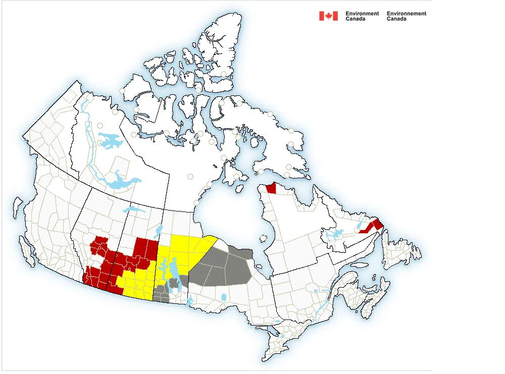
The snow has started to fall in many parts of Saskatchewan on Saturday and according to Environment Canada a good portion of the province is under either a snowfall warning or winter storm watch.
For the Saskatoon area the warning reads:
Snow at times heavy has begun this morning and will persist through the day. The snow will gradually taper off this evening, with total snowfall accumulations of 10 to 15 cm by tonight.
However, a second, more powerful system moves through the region on Sunday and Sunday night. This next system will bring a further 15 to 20 cm of snow to parts of central Saskatchewan along with wind gusts to 60 km/h and reduced visibility in blowing snow. Environment Canada says snowfall warnings now in effect will be further upgraded later today as this next system approaches the area.
Environment Canada recommends to being prepared to adjust your driving with changing road conditions. Rapidly accumulating snow will make travel difficult. Visibility may be suddenly reduced at times in heavy snow. Surfaces such as highways, roads, walkways and parking lots may become difficult to navigate due to accumulating snow. Public Safety Canada encourages everyone to make an emergency plan and get an emergency kit with drinking water, food, medicine, a first-aid kit and a flashlight. For information on emergency plans and kits go to http://www.getprepared.gc.ca.
Most of the province is predicted to get snow in the 10 to 15 cm range Saturday except for the Shaunavon, Maple Creek, Val Marie Cypress Hills area which are under a blizzard warning and could see 30 to 50 cm of snowfall expected, with heavy winds.
- For the latest weather forecast from the Saskatoon Area click here.
- For the forecast across Saskatchewan click here.
- Click here for the Saskatchewan Highway Hotline


